 vesseltracker.com
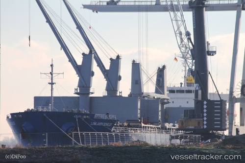
Vessel Argyroula Gs IMO: 9491587, MMSI: 538008712 General Cargo Ship
UTC, 31.82572, 34.64370, course: 115, speed: 0
UTC, 31.82567, 34.64366, course: 115, speed: 0
2026-01-31 15:31:49 UTC, 31.82574, 34.64367, course: 115, speed: 0
Live AIS position:
UTC. Near Ashdod Bonded),
updated 2026-01-31 15:31:49 UTC.
Find the position of the vessel Argyroula Gs on the map. The latter are known coordinates and path.
marine traffic ship tracker show on live map
The current position of vessel Argyroula Gs is 31.82574 lat / 34.64367 lng. Updated: 2026-01-31 15:31:49 UTCCurrently sailing under the flag of Marshall Islands
Details:
Last coordinates of the vessel:
UTC, 31.82568, 34.64372, course: 115, speed: 0UTC, 31.82572, 34.64370, course: 115, speed: 0
UTC, 31.82567, 34.64366, course: 115, speed: 0
2026-01-31 15:31:49 UTC, 31.82574, 34.64367, course: 115, speed: 0