 vesseltracker.com
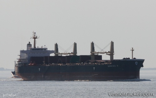
Vessel ANNIKA N IMO: 9514054, MMSI: 538008791 Bulk Carrier
UTC, 35.23473, -2.84373, course: 62, speed: 0.1
UTC, 35.23473, -2.84373, course: 62, speed: 0.1
2026-03-01 16:39:42 UTC, 35.23473, -2.84373, course: 62, speed: 0.1
Live AIS position:
UTC. Near NADOR),
updated 2026-03-01 16:39:42 UTC.
Find the position of the vessel ANNIKA N on the map. The latter are known coordinates and path.
marine traffic ship tracker show on live map
The current position of vessel ANNIKA N is 35.23473 lat / -2.84373 lng. Updated: 2026-03-01 16:39:42 UTCCurrently sailing under the flag of Marshall Islands
ANNIKA N built in 2011 year
Deadweight:
55768 tDetails:
Last coordinates of the vessel:
UTC, 35.23530, -2.84395, course: 70, speed: 0UTC, 35.23473, -2.84373, course: 62, speed: 0.1
UTC, 35.23473, -2.84373, course: 62, speed: 0.1
2026-03-01 16:39:42 UTC, 35.23473, -2.84373, course: 62, speed: 0.1