.
vessel RIDGEBURY MARY JANE IMO: 9337016, Crude Oil Tanker vesseltracker.com
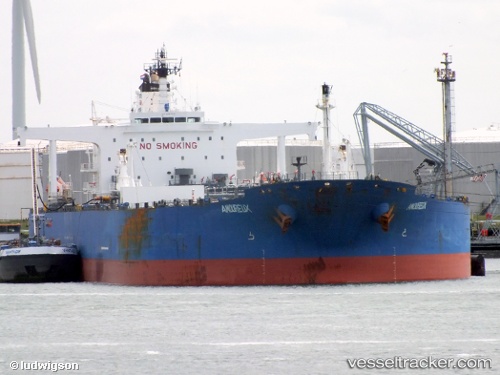
Vessel RIDGEBURY MARY JANE IMO: 9337016, MMSI: 538009259 Crude Oil Tanker

callsign: V7A4518
size: 273x48

Live AIS position: UTC. 76 nm E of Bernard), updated 2024-08-11 13:09:09 UTC.

Find the position of the vessel RIDGEBURY MARY JANE on the map. The latter are known coordinates and path.

marine traffic ship tracker show on live map

The current position of vessel RIDGEBURY MARY JANE is 69.15703 lat / -111.42611 lng. Updated: 2024-08-11 13:09:09 UTC

Currently sailing under the flag of Marshall Islands

RIDGEBURY MARY JANE built in 2008 year

Deadweight:
149993 t

Details:


Last coordinates of the vessel:
2024-08-11 13:09:09 UTC, 69.15703, -111.42611, course: 121, speed: 44.7


Most frequent ports a vessels calls at RIDGEBURY MARY JANE (538009259):

Maltepe, traffic: 3
Algeciras, traffic: 3
Canakkale, traffic: 2
Strait Of Gibraltar, traffic: 2
Gelibolu, traffic: 2
Genova, traffic: 1
Kung Thep, traffic: 1
Las Palmas, traffic: 1
Milazzo, traffic: 1
Puerto De La Luz, traffic: 1
Salvador, traffic: 1
Skagens Odde, traffic: 1
Gdansk, traffic: 1

Link to the map:


Find another ship

RIDGEBURY_MARY_JANE (538009259) last ports (portcalls and passsages)

Canakkale | 2023-09-21 06:37:45
Gelibolu | 2023-09-21 04:55:50
Maltepe | 2023-09-08 06:54:57
Maltepe | 2023-09-02 19:25:27
Maltepe | 2023-07-29 06:05:21
Gelibolu | 2023-07-27 11:59:13
Canakkale | 2023-07-27 09:55:46
Algeciras | 2023-04-30 00:12:26
Strait Of Gibraltar | 2023-04-11 12:34:50
Algeciras | 2023-04-09 10:01:59
Strait Of Gibraltar | 2023-04-02 13:29:02
Salvador | 2023-03-21 08:57:32
Algeciras | 2023-03-04 08:52:41
Genova | 2023-02-27 10:15:08
Milazzo | 2023-02-18 20:38:18
Forcados Offshore Terminal | 2023-01-31 05:14:16
Puerto De La Luz | 2023-01-23 05:30:40
Skagens Odde | 2023-01-14 02:25:19
Gdansk | 2023-01-03 11:03:20
Kung Thep | 2022-02-19 22:41:07