 vesseltracker.com
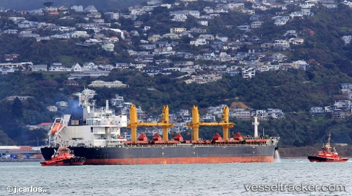
Vessel COMMON ATLAS IMO: 9669378, MMSI: 538009334 Bulk Carrier
UTC, -25.75223, -48.25354, course: -1, speed: 0.1
UTC, -25.75248, -48.25392, course: -1, speed: 0.1
2026-02-25 15:29:37 UTC, -25.75262, -48.25421, course: -1, speed: 0
Live AIS position:
UTC. 16 nm E of Caioba),
updated 2026-02-25 15:29:37 UTC.
Find the position of the vessel COMMON ATLAS on the map. The latter are known coordinates and path.
marine traffic ship tracker show on live map
The current position of vessel COMMON ATLAS is -25.75262 lat / -48.25421 lng. Updated: 2026-02-25 15:29:37 UTCCurrently sailing under the flag of Marshall Islands
COMMON ATLAS built in 2014 year
Deadweight:
62985 tDetails:
Last coordinates of the vessel:
UTC, -25.75249, -48.25391, course: -1, speed: 0.1UTC, -25.75223, -48.25354, course: -1, speed: 0.1
UTC, -25.75248, -48.25392, course: -1, speed: 0.1
2026-02-25 15:29:37 UTC, -25.75262, -48.25421, course: -1, speed: 0