 vesseltracker.com
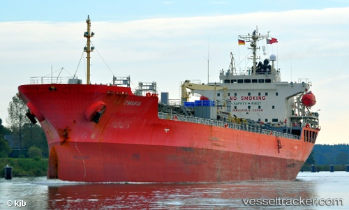
Vessel EASTERLY AS OMARIA IMO: 9363819, MMSI: 538009616 Chemical/Oil Products Tanker
UTC, -8.65500, -80.76167, course: -1, speed: 14
UTC, -8.32590, -81.08717, course: 319, speed: 14.2
2026-02-01 15:41:26 UTC, -8.07659, -81.32032, course: 318, speed: 14.4
Live AIS position:
UTC. 110 nm SW of Pimentel),
updated 2026-02-01 15:41:26 UTC.
Find the position of the vessel EASTERLY AS OMARIA on the map. The latter are known coordinates and path.
marine traffic ship tracker show on live map
The current position of vessel EASTERLY AS OMARIA is -8.07659 lat / -81.32032 lng. Updated: 2026-02-01 15:41:26 UTCCurrently sailing under the flag of Marshall Islands
EASTERLY AS OMARIA built in 2007 year
Deadweight:
19974 tDetails:
Last coordinates of the vessel:
UTC, -8.99176, -80.43674, course: 316, speed: 14.2UTC, -8.65500, -80.76167, course: -1, speed: 14
UTC, -8.32590, -81.08717, course: 319, speed: 14.2
2026-02-01 15:41:26 UTC, -8.07659, -81.32032, course: 318, speed: 14.4