 vesseltracker.com
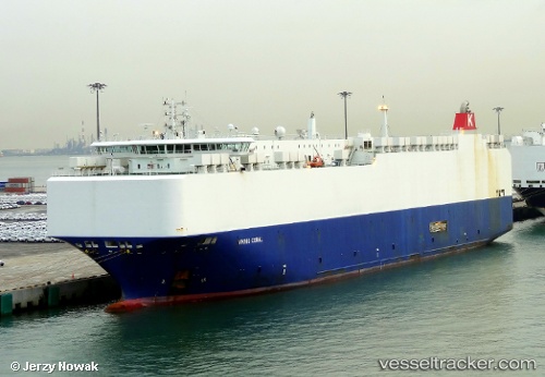
Vessel VIKING CORAL IMO: 9481051, MMSI: 538009726 Vehicles Carrier
UTC, 34.65048, 124.85452, course: 196, speed: 16.2
UTC, 34.37529, 124.75895, course: 217, speed: 16.3
2026-01-31 17:28:52 UTC, 34.37529, 124.75895, course: 217, speed: 16.3
Live AIS position:
UTC. 25 nm NW of Gageohyangri),
updated 2026-01-31 17:28:52 UTC.
Find the position of the vessel VIKING CORAL on the map. The latter are known coordinates and path.
marine traffic ship tracker show on live map
The current position of vessel VIKING CORAL is 34.37529 lat / 124.75895 lng. Updated: 2026-01-31 17:28:52 UTCCurrently sailing under the flag of Marshall Islands
VIKING CORAL built in 2011 year
Deadweight:
12588 tDetails:
Last coordinates of the vessel:
UTC, 34.65048, 124.85452, course: 196, speed: 16.2UTC, 34.65048, 124.85452, course: 196, speed: 16.2
UTC, 34.37529, 124.75895, course: 217, speed: 16.3
2026-01-31 17:28:52 UTC, 34.37529, 124.75895, course: 217, speed: 16.3