 vesseltracker.com
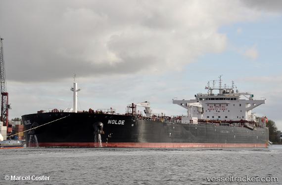
Vessel NOLDE IMO: 9787924, MMSI: 538009968 Crude Oil Tanker
UTC, 44.14486, 28.66557, course: 73, speed: 0
UTC, 44.14484, 28.66557, course: 73, speed: 0
2026-02-22 14:23:10 UTC, 44.14480, 28.66558, course: 73, speed: 0
Live AIS position:
UTC. Near Constanta),
updated 2026-02-22 14:23:10 UTC.
Find the position of the vessel NOLDE on the map. The latter are known coordinates and path.
marine traffic ship tracker show on live map
The current position of vessel NOLDE is 44.14480 lat / 28.66558 lng. Updated: 2026-02-22 14:23:10 UTCCurrently sailing under the flag of Marshall Islands
NOLDE built in 2018 year
Deadweight:
115024 tDetails:
Last coordinates of the vessel:
UTC, 44.14482, 28.66556, course: 73, speed: 0UTC, 44.14486, 28.66557, course: 73, speed: 0
UTC, 44.14484, 28.66557, course: 73, speed: 0
2026-02-22 14:23:10 UTC, 44.14480, 28.66558, course: 73, speed: 0