 vesseltracker.com
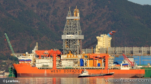
Vessel WEST DORADO IMO: 9705469, MMSI: 538010049 Drilling Ship
Live AIS position:
UTC. 51 nm NW of Suursaq),
updated 2025-12-14 08:00:42 UTC.
Find the position of the vessel WEST DORADO on the map. The latter are known coordinates and path.
marine traffic ship tracker show on live map
The current position of vessel WEST DORADO is 81.26245 lat / -71.30955 lng. Updated: 2025-12-14 08:00:42 UTCCurrently sailing under the flag of Marshall Islands
WEST DORADO built in 2022 year
Deadweight:
58975 tDetails:
Last coordinates of the vessel:
2025-12-14 08:00:42 UTC, 81.26245, -71.30955, course: 154, speed: 87.1