 vesseltracker.com
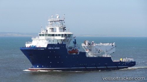
Vessel SAFEEN SURVEYOR IMO: 9444778, MMSI: 538010173 Offshore Support Vessel
UTC, 26.60756, 50.28589, course: 44, speed: 0
UTC, 26.60756, 50.28589, course: 44, speed: 0
2026-01-31 08:25:32 UTC, 26.60756, 50.28589, course: 44, speed: 0
Live AIS position:
UTC. Near Ras Tannurah),
updated 2026-01-31 08:25:32 UTC.
Find the position of the vessel SAFEEN SURVEYOR on the map. The latter are known coordinates and path.
marine traffic ship tracker show on live map
The current position of vessel SAFEEN SURVEYOR is 26.60756 lat / 50.28589 lng. Updated: 2026-01-31 08:25:32 UTCCurrently sailing under the flag of Marshall Islands
SAFEEN SURVEYOR built in 2014 year
Deadweight:
3066 tDetails:
Last coordinates of the vessel:
UTC, 26.60879, 50.28540, course: 90, speed: 0.1UTC, 26.60756, 50.28589, course: 44, speed: 0
UTC, 26.60756, 50.28589, course: 44, speed: 0
2026-01-31 08:25:32 UTC, 26.60756, 50.28589, course: 44, speed: 0