 vesseltracker.com
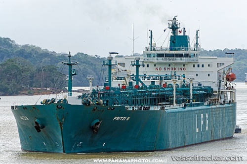
Vessel FRITZI N IMO: 9407122, MMSI: 538010305 Lpg Tanker
UTC, 5.71510, 80.71428, course: 80, speed: 12.7
UTC, 5.72543, 80.78914, course: 92, speed: 13.1
2026-02-28 03:10:34 UTC, 5.73587, 81.30647, course: -1, speed: 11.1
Live AIS position:
UTC. 26 nm SE of HAMBANTOTA),
updated 2026-02-28 03:10:34 UTC.
Find the position of the vessel FRITZI N on the map. The latter are known coordinates and path.
marine traffic ship tracker show on live map
The current position of vessel FRITZI N is 5.73587 lat / 81.30647 lng. Updated: 2026-02-28 03:10:34 UTCCurrently sailing under the flag of Marshall Islands
Details:
Last coordinates of the vessel:
UTC, 5.68523, 80.10094, course: -1, speed: 13.8UTC, 5.71510, 80.71428, course: 80, speed: 12.7
UTC, 5.72543, 80.78914, course: 92, speed: 13.1
2026-02-28 03:10:34 UTC, 5.73587, 81.30647, course: -1, speed: 11.1