 vesseltracker.com
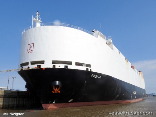
Vessel VIKING PAGLIA IMO: 9427940, MMSI: 538010369 Vehicles Carrier
UTC, -33.59524, 151.94139, course: 220, speed: 19.2
UTC, -34.06875, 151.51364, course: 220, speed: 13.8
2026-03-01 21:26:26 UTC, -34.22823, 151.28296, course: 256, speed: 14.8
Live AIS position:
UTC. 11 nm S of Smeaton Grange),
updated 2026-03-01 21:26:26 UTC.
Find the position of the vessel VIKING PAGLIA on the map. The latter are known coordinates and path.
marine traffic ship tracker show on live map
The current position of vessel VIKING PAGLIA is -34.22823 lat / 151.28296 lng. Updated: 2026-03-01 21:26:26 UTCCurrently sailing under the flag of Marshall Islands
Details:
Last coordinates of the vessel:
UTC, -32.89858, 152.54500, course: 221, speed: 19.8UTC, -33.59524, 151.94139, course: 220, speed: 19.2
UTC, -34.06875, 151.51364, course: 220, speed: 13.8
2026-03-01 21:26:26 UTC, -34.22823, 151.28296, course: 256, speed: 14.8