 vesseltracker.com
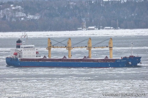
Vessel SAFEEN AL NASR IMO: 9612296, MMSI: 538010392 Bulk Carrier
UTC, 24.11486, 60.18134, course: -1, speed: 11.3
UTC, 24.29082, 59.84044, course: -1, speed: 10.9
2026-02-26 18:30:12 UTC, 24.52160, 59.40822, course: -1, speed: 10.1
Live AIS position:
UTC. 69 nm NE of Port Sultan),
updated 2026-02-26 18:30:12 UTC.
Find the position of the vessel SAFEEN AL NASR on the map. The latter are known coordinates and path.
marine traffic ship tracker show on live map
The current position of vessel SAFEEN AL NASR is 24.52160 lat / 59.40822 lng. Updated: 2026-02-26 18:30:12 UTCCurrently sailing under the flag of Marshall Islands
Details:
Last coordinates of the vessel:
UTC, 23.76123, 60.57655, course: -1, speed: 11.5UTC, 24.11486, 60.18134, course: -1, speed: 11.3
UTC, 24.29082, 59.84044, course: -1, speed: 10.9
2026-02-26 18:30:12 UTC, 24.52160, 59.40822, course: -1, speed: 10.1