 vesseltracker.com
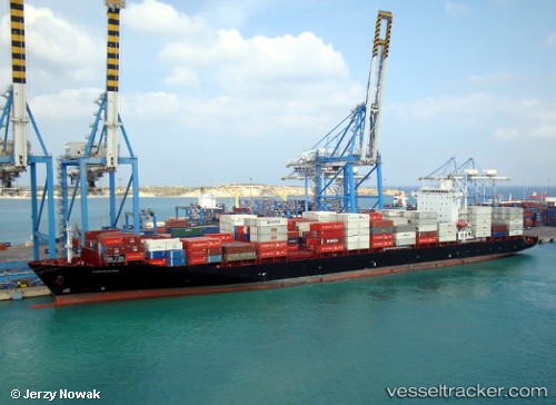
Vessel YOKOHAMA STAR IMO: 9322346, MMSI: 538010808 Container Ship
UTC, 18.83343, 72.55720, course: 191, speed: 11.8
UTC, 18.37622, 72.50904, course: 174, speed: 12.4
2026-02-27 11:46:17 UTC, 18.04569, 72.57157, course: -1, speed: 12.2
Live AIS position:
UTC. 26 nm SW of Dighi (Pune)),
updated 2026-02-27 11:46:17 UTC.
Find the position of the vessel YOKOHAMA STAR on the map. The latter are known coordinates and path.
marine traffic ship tracker show on live map
The current position of vessel YOKOHAMA STAR is 18.04569 lat / 72.57157 lng. Updated: 2026-02-27 11:46:17 UTCCurrently sailing under the flag of Marshall Islands
Details:
Last coordinates of the vessel:
UTC, 18.90018, 72.85738, course: 208, speed: 9UTC, 18.83343, 72.55720, course: 191, speed: 11.8
UTC, 18.37622, 72.50904, course: 174, speed: 12.4
2026-02-27 11:46:17 UTC, 18.04569, 72.57157, course: -1, speed: 12.2