 vesseltracker.com
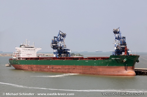
Vessel JOHNY IMO: 9537903, MMSI: 538011169 Bulk Carrier
UTC, 35.76727, 30.95350, course: 271, speed: 12.1
UTC, 35.75233, 30.29384, course: 268, speed: 12.6
2026-02-24 02:07:09 UTC, 35.73986, 29.67582, course: 269, speed: 13
Live AIS position:
UTC. 25 nm S of Kastellorizou (ex Megísti)),
updated 2026-02-24 02:07:09 UTC.
Find the position of the vessel JOHNY on the map. The latter are known coordinates and path.
marine traffic ship tracker show on live map
The current position of vessel JOHNY is 35.73986 lat / 29.67582 lng. Updated: 2026-02-24 02:07:09 UTCCurrently sailing under the flag of Marshall Islands
Details:
Last coordinates of the vessel:
UTC, 35.76667, 31.22333, course: -1, speed: 12UTC, 35.76727, 30.95350, course: 271, speed: 12.1
UTC, 35.75233, 30.29384, course: 268, speed: 12.6
2026-02-24 02:07:09 UTC, 35.73986, 29.67582, course: 269, speed: 13