 vesseltracker.com
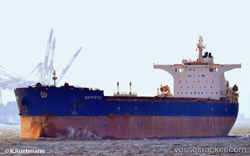
Vessel SEA PUMA IMO: 9469871, MMSI: 538011420 Bulk Carrier
UTC, 44.80333, 30.17833, course: -1, speed: 0
UTC, 44.80333, 30.17833, course: -1, speed: 0
2026-02-26 04:15:11 UTC, 44.80333, 30.17833, course: -1, speed: 0
Live AIS position:
UTC. 30 nm SE of Sulina (Port et Zone Franche)),
updated 2026-02-26 04:15:11 UTC.
Find the position of the vessel SEA PUMA on the map. The latter are known coordinates and path.
marine traffic ship tracker show on live map
The current position of vessel SEA PUMA is 44.80333 lat / 30.17833 lng. Updated: 2026-02-26 04:15:11 UTCCurrently sailing under the flag of Marshall Islands
Details:
Last coordinates of the vessel:
UTC, 44.80333, 30.17833, course: -1, speed: 0UTC, 44.80333, 30.17833, course: -1, speed: 0
UTC, 44.80333, 30.17833, course: -1, speed: 0
2026-02-26 04:15:11 UTC, 44.80333, 30.17833, course: -1, speed: 0