 vesseltracker.com
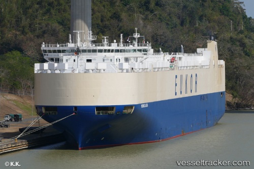
Vessel MORNING LAURA IMO: 9445992, MMSI: 538011674 Vehicles Carrier
UTC, -23.62244, 56.89797, course: 245, speed: 17.6
UTC, -23.99060, 56.10915, course: 241, speed: 17.8
2026-02-26 11:25:41 UTC, -24.13136, 55.81065, course: 242, speed: 17.9
Live AIS position:
UTC. 153 nm W of Al Azaiba),
updated 2026-02-26 11:25:41 UTC.
Find the position of the vessel MORNING LAURA on the map. The latter are known coordinates and path.
marine traffic ship tracker show on live map
The current position of vessel MORNING LAURA is -24.13136 lat / 55.81065 lng. Updated: 2026-02-26 11:25:41 UTCCurrently sailing under the flag of Marshall Islands
Details:
Last coordinates of the vessel:
UTC, -23.42875, 57.30227, course: 242, speed: 17.6UTC, -23.62244, 56.89797, course: 245, speed: 17.6
UTC, -23.99060, 56.10915, course: 241, speed: 17.8
2026-02-26 11:25:41 UTC, -24.13136, 55.81065, course: 242, speed: 17.9