 vesseltracker.com
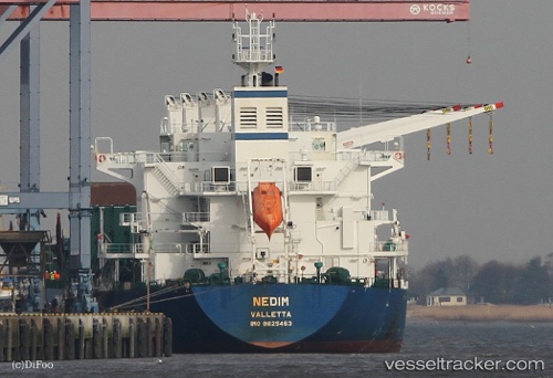
Vessel NEGMAR YAKO I IMO: 9625463, MMSI: 538011706 Cargo
UTC, 39.88835, 26.13672, course: -1, speed: 0
UTC, 39.88835, 26.13647, course: -1, speed: 0.1
2026-02-26 08:29:49 UTC, 39.88835, 26.13647, course: -1, speed: 0.1
Live AIS position:
UTC. Near Bozcaada),
updated 2026-02-26 08:29:49 UTC.
Find the position of the vessel NEGMAR YAKO I on the map. The latter are known coordinates and path.
marine traffic ship tracker show on live map
The current position of vessel NEGMAR YAKO I is 39.88835 lat / 26.13647 lng. Updated: 2026-02-26 08:29:49 UTCCurrently sailing under the flag of Marshall Islands
Details:
Last coordinates of the vessel:
UTC, 39.88887, 26.13546, course: -1, speed: 0.3UTC, 39.88835, 26.13672, course: -1, speed: 0
UTC, 39.88835, 26.13647, course: -1, speed: 0.1
2026-02-26 08:29:49 UTC, 39.88835, 26.13647, course: -1, speed: 0.1