 vesseltracker.com
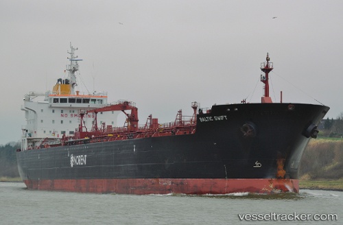
Vessel SWIFT IMO: 9464376, MMSI: 538011811 Oil/Chemical Tanker
UTC, -47.72013, -75.86195, course: 4, speed: 12.4
UTC, -47.33009, -75.82503, course: 1, speed: 12.1
2026-02-26 00:22:53 UTC, -46.74472, -75.80065, course: 0, speed: 12.4
Live AIS position:
UTC. 112 nm NW of TORTEL),
updated 2026-02-26 00:22:53 UTC.
Find the position of the vessel SWIFT on the map. The latter are known coordinates and path.
marine traffic ship tracker show on live map
The current position of vessel SWIFT is -46.74472 lat / -75.80065 lng. Updated: 2026-02-26 00:22:53 UTCCurrently sailing under the flag of Marshall Islands
Details:
Last coordinates of the vessel:
UTC, -48.06115, -75.86695, course: 1, speed: 12.5UTC, -47.72013, -75.86195, course: 4, speed: 12.4
UTC, -47.33009, -75.82503, course: 1, speed: 12.1
2026-02-26 00:22:53 UTC, -46.74472, -75.80065, course: 0, speed: 12.4