 vesseltracker.com
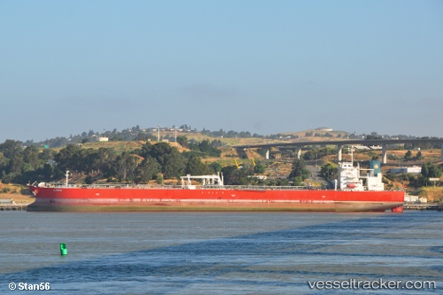
Vessel ALQADISIA IMO: 9343352, MMSI: 538011949 Crude Oil Tanker
UTC, 23.74463, 37.38938, course: 243, speed: 1.8
UTC, 23.69808, 37.37810, course: 245, speed: 1.8
2026-02-28 07:33:56 UTC, 23.64373, 37.35747, course: 236, speed: 1.9
Live AIS position:
UTC. 45 nm SW of Yanbu),
updated 2026-02-28 07:33:56 UTC.
Find the position of the vessel ALQADISIA on the map. The latter are known coordinates and path.
marine traffic ship tracker show on live map
The current position of vessel ALQADISIA is 23.64373 lat / 37.35747 lng. Updated: 2026-02-28 07:33:56 UTCCurrently sailing under the flag of Marshall Islands
Details:
Last coordinates of the vessel:
UTC, 23.82493, 37.40487, course: 239, speed: 2UTC, 23.74463, 37.38938, course: 243, speed: 1.8
UTC, 23.69808, 37.37810, course: 245, speed: 1.8
2026-02-28 07:33:56 UTC, 23.64373, 37.35747, course: 236, speed: 1.9