 vesseltracker.com
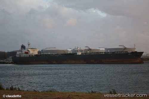
Vessel LV ESTIA IMO: 9327035, MMSI: 538012187 Crude Oil Tanker
UTC, 27.08497, 49.70123, course: -1, speed: 0
UTC, 27.08497, 49.70123, course: -1, speed: 0
2026-02-26 03:27:26 UTC, 27.08498, 49.70122, course: -1, speed: 0
Live AIS position:
UTC. Near AL JUBAIL),
updated 2026-02-26 03:27:26 UTC.
Find the position of the vessel LV ESTIA on the map. The latter are known coordinates and path.
marine traffic ship tracker show on live map
The current position of vessel LV ESTIA is 27.08498 lat / 49.70122 lng. Updated: 2026-02-26 03:27:26 UTCCurrently sailing under the flag of Marshall Islands
Details:
Last coordinates of the vessel:
UTC, 27.06527, 49.70858, course: 298, speed: 4.8UTC, 27.08497, 49.70123, course: -1, speed: 0
UTC, 27.08497, 49.70123, course: -1, speed: 0
2026-02-26 03:27:26 UTC, 27.08498, 49.70122, course: -1, speed: 0