 vesseltracker.com
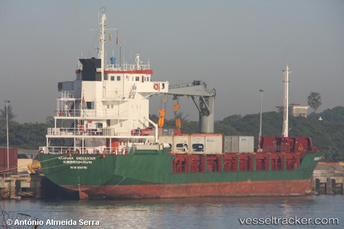
Vessel Moreta Cargo 2 IMO: 9000780, MMSI: 548545200 General Cargo Ship
UTC, 12.27613, 122.47015, course: 131, speed: 10.5
UTC, 12.27613, 122.47015, course: 131, speed: 10.5
2026-02-10 09:57:49 UTC, 12.27613, 122.47015, course: 131, speed: 10.5
Live AIS position:
UTC. 14 nm SW of Cajidiocan, Visayan Isl),
updated 2026-02-10 09:57:49 UTC.
Find the position of the vessel Moreta Cargo 2 on the map. The latter are known coordinates and path.
marine traffic ship tracker show on live map
The current position of vessel Moreta Cargo 2 is 12.27613 lat / 122.47015 lng. Updated: 2026-02-10 09:57:49 UTCCurrently sailing under the flag of Philippines
Details:
Last coordinates of the vessel:
UTC, 12.36436, 122.35128, course: 132, speed: 9.9UTC, 12.27613, 122.47015, course: 131, speed: 10.5
UTC, 12.27613, 122.47015, course: 131, speed: 10.5
2026-02-10 09:57:49 UTC, 12.27613, 122.47015, course: 131, speed: 10.5