 vesseltracker.com
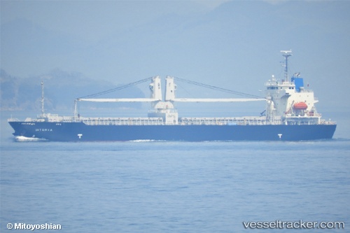
Vessel Istorya IMO: 9543988, MMSI: 548854000 General Cargo Ship
UTC, -6.10018, 106.88699, course: 2, speed: 0
UTC, -6.10018, 106.88698, course: 2, speed: 0
2026-02-04 17:39:53 UTC, -6.03719, 106.87977, course: 348, speed: 12.1
Live AIS position:
UTC. Near New Priok Port),
updated 2026-02-04 17:39:53 UTC.
Find the position of the vessel Istorya on the map. The latter are known coordinates and path.
marine traffic ship tracker show on live map
The current position of vessel Istorya is -6.03719 lat / 106.87977 lng. Updated: 2026-02-04 17:39:53 UTCCurrently sailing under the flag of Philippines
Istorya built in 2012 year
Deadweight:
12973 tDetails:
Last coordinates of the vessel:
UTC, -6.10013, 106.88697, course: 2, speed: 0UTC, -6.10018, 106.88699, course: 2, speed: 0
UTC, -6.10018, 106.88698, course: 2, speed: 0
2026-02-04 17:39:53 UTC, -6.03719, 106.87977, course: 348, speed: 12.1