 vesseltracker.com
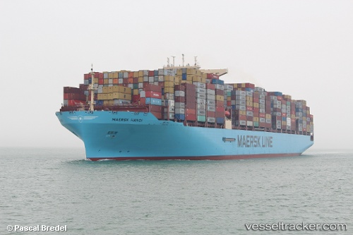
Vessel Maersk Hanoi IMO: 9784295, MMSI: 563039700 Container Ship
UTC, 16.87667, 55.06833, course: -1, speed: 11
UTC, 16.96167, 55.35333, course: -1, speed: 11
2026-02-02 15:46:05 UTC, 17.10833, 55.78833, course: -1, speed: 11
Live AIS position:
UTC. 101 nm E of Mina Raysut),
updated 2026-02-02 15:46:05 UTC.
Find the position of the vessel Maersk Hanoi on the map. The latter are known coordinates and path.
marine traffic ship tracker show on live map
The current position of vessel Maersk Hanoi is 17.10833 lat / 55.78833 lng. Updated: 2026-02-02 15:46:05 UTCCurrently sailing under the flag of Singapore
Details:
Last coordinates of the vessel:
UTC, 16.86320, 54.62873, course: 91, speed: 12.1UTC, 16.87667, 55.06833, course: -1, speed: 11
UTC, 16.96167, 55.35333, course: -1, speed: 11
2026-02-02 15:46:05 UTC, 17.10833, 55.78833, course: -1, speed: 11