 vesseltracker.com
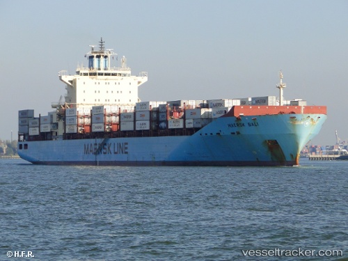
Vessel Maersk Bali IMO: 9394870, MMSI: 563102000 Container Ship
UTC, 19.53217, -66.80136, course: 238, speed: 19.1
UTC, 19.23167, -67.38333, course: -1, speed: 19
2026-03-05 08:29:40 UTC, 18.48333, -67.96833, course: -1, speed: 17
Live Vessel Maersk Bali Analytics (details, animations, etc.)
Live AIS position: UTC. 22 nm E of Punta Cana Apt), updated 2026-03-05 08:29:40 UTC.Find the position of the vessel Maersk Bali on the map. The latter are known coordinates and path.
marine traffic ship tracker show on live map
The current position of vessel Maersk Bali is 18.48333 lat / -67.96833 lng. Updated: 2026-03-05 08:29:40 UTCCurrently sailing under the flag of Singapore
Maersk Bali built in 2008 year
Deadweight:
43206 tDetails:
Last coordinates of the vessel:
UTC, 19.83833, -66.10833, course: -1, speed: 19UTC, 19.53217, -66.80136, course: 238, speed: 19.1
UTC, 19.23167, -67.38333, course: -1, speed: 19
2026-03-05 08:29:40 UTC, 18.48333, -67.96833, course: -1, speed: 17