 vesseltracker.com
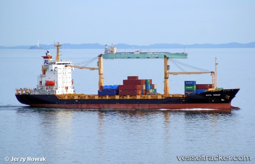
Vessel KOTA RAKAN IMO: 9359686, MMSI: 563138100 Container Ship
UTC, 6.13888, 1.28792, course: 164, speed: 3.6
UTC, 6.04855, 1.57473, course: 84, speed: 13.9
2026-02-03 21:47:31 UTC, 6.09342, 1.92545, course: 80, speed: 14
Live AIS position:
UTC. 19 nm SW of Ouidah),
updated 2026-02-03 21:47:31 UTC.
Find the position of the vessel KOTA RAKAN on the map. The latter are known coordinates and path.
marine traffic ship tracker show on live map
The current position of vessel KOTA RAKAN is 6.09342 lat / 1.92545 lng. Updated: 2026-02-03 21:47:31 UTCCurrently sailing under the flag of Singapore
KOTA RAKAN built in 2008 year
Deadweight:
12997 tDetails:
Last coordinates of the vessel:
UTC, 6.14387, 1.28613, course: 257, speed: 0UTC, 6.13888, 1.28792, course: 164, speed: 3.6
UTC, 6.04855, 1.57473, course: 84, speed: 13.9
2026-02-03 21:47:31 UTC, 6.09342, 1.92545, course: 80, speed: 14