 vesseltracker.com
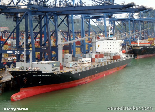
Vessel MAERSK WAKAYAMA IMO: 9550357, MMSI: 563188500 Container Ship
UTC, 32.89264, 34.84134, course: 110, speed: 6.4
UTC, 32.90030, 34.90889, course: 316, speed: 1.6
2026-02-24 15:53:27 UTC, 32.91255, 34.90523, course: 352, speed: 1.5
Live AIS position:
UTC. Near Haifa),
updated 2026-02-24 15:53:27 UTC.
Find the position of the vessel MAERSK WAKAYAMA on the map. The latter are known coordinates and path.
marine traffic ship tracker show on live map
The current position of vessel MAERSK WAKAYAMA is 32.91255 lat / 34.90523 lng. Updated: 2026-02-24 15:53:27 UTCCurrently sailing under the flag of Singapore
Details:
Last coordinates of the vessel:
UTC, 31.80871, 32.80507, course: 43, speed: 17.6UTC, 32.89264, 34.84134, course: 110, speed: 6.4
UTC, 32.90030, 34.90889, course: 316, speed: 1.6
2026-02-24 15:53:27 UTC, 32.91255, 34.90523, course: 352, speed: 1.5