 vesseltracker.com
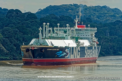
Vessel BW CLEAR SKY IMO: 9413327, MMSI: 563223100 Lng Tanker
UTC, 23.97833, -85.69667, course: -1, speed: 18
UTC, 23.85833, -85.31167, course: -1, speed: 18
2026-03-01 10:31:11 UTC, 23.56118, -84.28724, course: -1, speed: 18.9
Live AIS position:
UTC. 55 nm N of Santa Lucia),
updated 2026-03-01 10:31:11 UTC.
Find the position of the vessel BW CLEAR SKY on the map. The latter are known coordinates and path.
marine traffic ship tracker show on live map
The current position of vessel BW CLEAR SKY is 23.56118 lat / -84.28724 lng. Updated: 2026-03-01 10:31:11 UTCCurrently sailing under the flag of Singapore
Details:
Last coordinates of the vessel:
UTC, 24.20167, -86.51833, course: -1, speed: 18UTC, 23.97833, -85.69667, course: -1, speed: 18
UTC, 23.85833, -85.31167, course: -1, speed: 18
2026-03-01 10:31:11 UTC, 23.56118, -84.28724, course: -1, speed: 18.9