 vesseltracker.com
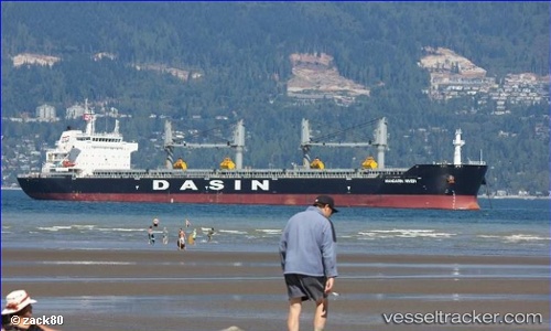
Vessel MANDARIN RIVER IMO: 9533335, MMSI: 563228900 Bulk Carrier
UTC, 12.93125, 74.81080, course: 351, speed: 0
UTC, 12.93090, 74.81093, course: 350, speed: 0.1
2026-03-15 21:57:51 UTC, 12.93097, 74.81077, course: 351, speed: 0
Live Vessel MANDARIN RIVER Analytics (details, animations, etc.)
Live AIS position: UTC. Near PANAMBUR), updated 2026-03-15 21:57:51 UTC.Find the position of the vessel MANDARIN RIVER on the map. The latter are known coordinates and path.
marine traffic ship tracker show on live map
The current position of vessel MANDARIN RIVER is 12.93097 lat / 74.81077 lng. Updated: 2026-03-15 21:57:51 UTCCurrently sailing under the flag of Singapore
Details:
Last coordinates of the vessel:
UTC, 12.93087, 74.81067, course: 351, speed: 0UTC, 12.93125, 74.81080, course: 351, speed: 0
UTC, 12.93090, 74.81093, course: 350, speed: 0.1
2026-03-15 21:57:51 UTC, 12.93097, 74.81077, course: 351, speed: 0