 vesseltracker.com
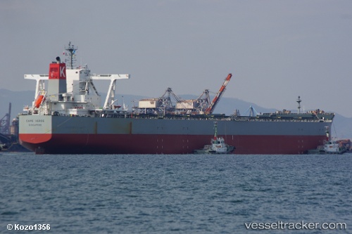
Vessel Cape Verde IMO: 9670054, MMSI: 563640000 Bulk Carrier
UTC, -23.81543, 151.23886, course: 138, speed: 0
UTC, -23.81542, 151.23882, course: 138, speed: 0
2026-01-25 11:59:34 UTC, -23.81541, 151.23889, course: 139, speed: 0
Live AIS position:
UTC. Near GLADSTONE),
updated 2026-01-25 11:59:34 UTC.
Find the position of the vessel Cape Verde on the map. The latter are known coordinates and path.
marine traffic ship tracker show on live map
The current position of vessel Cape Verde is -23.81541 lat / 151.23889 lng. Updated: 2026-01-25 11:59:34 UTCDetails:
Last coordinates of the vessel:
UTC, -23.81546, 151.23885, course: 139, speed: 0UTC, -23.81543, 151.23886, course: 138, speed: 0
UTC, -23.81542, 151.23882, course: 138, speed: 0
2026-01-25 11:59:34 UTC, -23.81541, 151.23889, course: 139, speed: 0