 vesseltracker.com
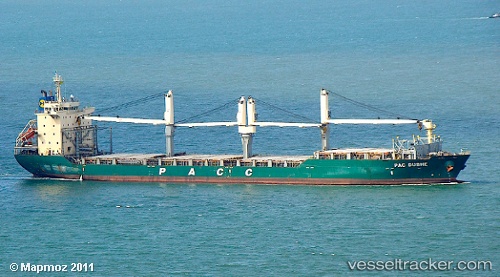
Vessel Pac Dubhe IMO: 9304021, MMSI: 565169000 Multi Purpose Carrier
UTC, 34.71500, -76.70167, course: -1, speed: 0
UTC, 34.71513, -76.70324, course: 84, speed: 0
2026-03-10 17:53:55 UTC, 34.71509, -76.70319, course: 84, speed: 0
Live Vessel Pac Dubhe Analytics (details, animations, etc.)
Live AIS position: UTC. Near BEAUFORT), updated 2026-03-10 17:53:55 UTC.Find the position of the vessel Pac Dubhe on the map. The latter are known coordinates and path.
marine traffic ship tracker show on live map
The current position of vessel Pac Dubhe is 34.71509 lat / -76.70319 lng. Updated: 2026-03-10 17:53:55 UTCCurrently sailing under the flag of Singapore
Pac Dubhe built in 2006 year
Deadweight:
27408 tDetails:
Last coordinates of the vessel:
UTC, 34.71511, -76.70328, course: 84, speed: 0UTC, 34.71500, -76.70167, course: -1, speed: 0
UTC, 34.71513, -76.70324, course: 84, speed: 0
2026-03-10 17:53:55 UTC, 34.71509, -76.70319, course: 84, speed: 0