 vesseltracker.com
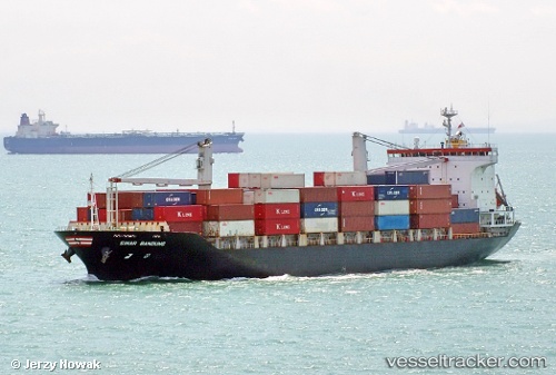
Vessel Sinar Bandung IMO: 9352432, MMSI: 566127000 Container Ship
UTC, 3.95265, 103.48162, course: 25, speed: 0
UTC, 3.97399, 103.41975, course: 146, speed: 0
2026-02-06 15:44:51 UTC, 3.97397, 103.41972, course: 146, speed: 0
Live AIS position:
UTC. Near Gebeng),
updated 2026-02-06 15:44:51 UTC.
Find the position of the vessel Sinar Bandung on the map. The latter are known coordinates and path.
marine traffic ship tracker show on live map
The current position of vessel Sinar Bandung is 3.97397 lat / 103.41972 lng. Updated: 2026-02-06 15:44:51 UTCCurrently sailing under the flag of Singapore
Sinar Bandung built in 2005 year
Deadweight:
14984 tDetails:
Last coordinates of the vessel:
UTC, 3.95164, 103.48189, course: 29, speed: 0UTC, 3.95265, 103.48162, course: 25, speed: 0
UTC, 3.97399, 103.41975, course: 146, speed: 0
2026-02-06 15:44:51 UTC, 3.97397, 103.41972, course: 146, speed: 0