 vesseltracker.com
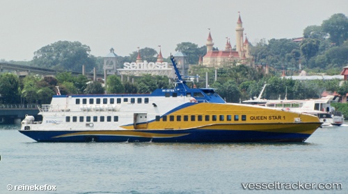
Vessel Queen Star 1 IMO: 9571014, MMSI: 566155000 Passenger Ship
UTC, 1.27717, 103.98353, course: 352, speed: 15.4
UTC, 1.23988, 104.00580, course: 147, speed: 23.4
2026-01-31 08:07:13 UTC, 1.13384, 104.05532, course: 37, speed: 0.5
Live AIS position:
UTC. Near Batam Island),
updated 2026-01-31 08:07:13 UTC.
Find the position of the vessel Queen Star 1 on the map. The latter are known coordinates and path.
marine traffic ship tracker show on live map
The current position of vessel Queen Star 1 is 1.13384 lat / 104.05532 lng. Updated: 2026-01-31 08:07:13 UTCDetails:
Last coordinates of the vessel:
UTC, 1.23636, 103.99283, course: 143, speed: 22.1UTC, 1.27717, 103.98353, course: 352, speed: 15.4
UTC, 1.23988, 104.00580, course: 147, speed: 23.4
2026-01-31 08:07:13 UTC, 1.13384, 104.05532, course: 37, speed: 0.5