 vesseltracker.com
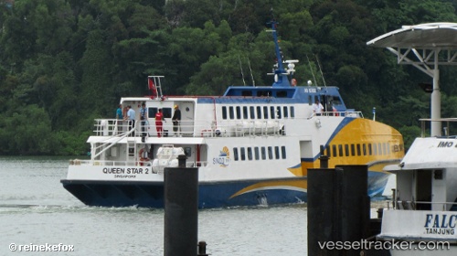
Vessel Queen Star 2 IMO: 9571026, MMSI: 566156000 Passenger Ship
UTC, 1.26299, 103.81972, course: -1, speed: 3.5
UTC, 1.26289, 103.81943, course: -1, speed: 0.2
2026-01-29 23:44:11 UTC, 1.19979, 103.98059, course: -1, speed: 23
Live AIS position:
UTC. Near BATU AMPAR),
updated 2026-01-29 23:44:11 UTC.
Find the position of the vessel Queen Star 2 on the map. The latter are known coordinates and path.
marine traffic ship tracker show on live map
The current position of vessel Queen Star 2 is 1.19979 lat / 103.98059 lng. Updated: 2026-01-29 23:44:11 UTCDetails:
Last coordinates of the vessel:
UTC, 1.26299, 103.81972, course: -1, speed: 3.5UTC, 1.26299, 103.81972, course: -1, speed: 3.5
UTC, 1.26289, 103.81943, course: -1, speed: 0.2
2026-01-29 23:44:11 UTC, 1.19979, 103.98059, course: -1, speed: 23