 vesseltracker.com
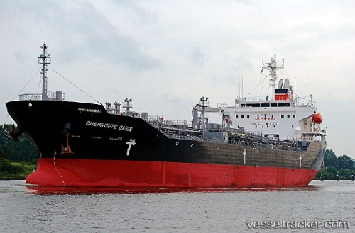
Vessel OASIS IMO: 9512173, MMSI: 572794220 Oil/Chemical Tanker
UTC, 26.45210, 119.70735, course: 126, speed: 0
UTC, 26.45211, 119.70734, course: 126, speed: 0
2026-03-01 07:56:21 UTC, 26.45207, 119.70734, course: 126, speed: 0
Live AIS position:
UTC. Near Luoyuanwan),
updated 2026-03-01 07:56:21 UTC.
Find the position of the vessel OASIS on the map. The latter are known coordinates and path.
marine traffic ship tracker show on live map
The current position of vessel OASIS is 26.45207 lat / 119.70734 lng. Updated: 2026-03-01 07:56:21 UTCCurrently sailing under the flag of Tuvalu
Details:
Last coordinates of the vessel:
UTC, 26.45212, 119.70729, course: 126, speed: 0UTC, 26.45210, 119.70735, course: 126, speed: 0
UTC, 26.45211, 119.70734, course: 126, speed: 0
2026-03-01 07:56:21 UTC, 26.45207, 119.70734, course: 126, speed: 0