 vesseltracker.com
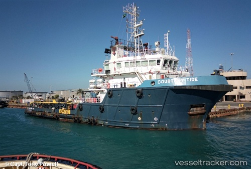
Vessel Courtney Tide IMO: 9582192, MMSI: 576255000 Offshore Tug Supply Ship
UTC, 24.99741, 55.05246, course: 337, speed: 0
UTC, 24.99741, 55.05246, course: 338, speed: 0
2026-01-18 13:40:33 UTC, 24.99740, 55.05243, course: 337, speed: 0
Live AIS position:
UTC. Near Jebel Ali Free Zone),
updated 2026-01-18 13:40:33 UTC.
Find the position of the vessel Courtney Tide on the map. The latter are known coordinates and path.
marine traffic ship tracker show on live map
The current position of vessel Courtney Tide is 24.99740 lat / 55.05243 lng. Updated: 2026-01-18 13:40:33 UTCDetails:
Last coordinates of the vessel:
UTC, 24.99735, 55.05243, course: 338, speed: 0UTC, 24.99741, 55.05246, course: 337, speed: 0
UTC, 24.99741, 55.05246, course: 338, speed: 0
2026-01-18 13:40:33 UTC, 24.99740, 55.05243, course: 337, speed: 0