 vesseltracker.com
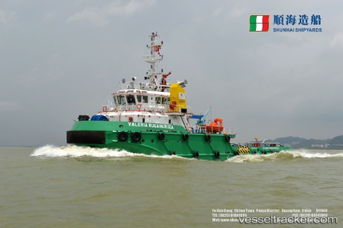
Vessel Nyangumi 2 IMO: 9796030, MMSI: 577328000 Tug
UTC, 36.66631, 122.47974, course: 311, speed: 0.2
UTC, 36.66559, 122.47796, course: 45, speed: 0
2026-02-22 06:00:57 UTC, 36.66600, 122.47739, course: 83, speed: 0
Live AIS position:
UTC. 12 nm S of Shidao Pt),
updated 2026-02-22 06:00:57 UTC.
Find the position of the vessel Nyangumi 2 on the map. The latter are known coordinates and path.
marine traffic ship tracker show on live map
The current position of vessel Nyangumi 2 is 36.66600 lat / 122.47739 lng. Updated: 2026-02-22 06:00:57 UTCDetails:
Last coordinates of the vessel:
UTC, 36.66671, 122.47965, course: 297, speed: 0.9UTC, 36.66631, 122.47974, course: 311, speed: 0.2
UTC, 36.66559, 122.47796, course: 45, speed: 0
2026-02-22 06:00:57 UTC, 36.66600, 122.47739, course: 83, speed: 0