 vesseltracker.com
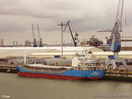
Vessel DEK IMO: 9555357, MMSI: 577422000 General Cargo
UTC, 34.70500, 24.31833, course: -1, speed: 7
UTC, 34.70619, 24.16977, course: 273, speed: 7.9
2026-02-28 07:24:08 UTC, 34.69667, 23.76500, course: -1, speed: 7
Live AIS position:
UTC. 20 nm SW of Gavdos Chanea),
updated 2026-02-28 07:24:08 UTC.
Find the position of the vessel DEK on the map. The latter are known coordinates and path.
marine traffic ship tracker show on live map
The current position of vessel DEK is 34.69667 lat / 23.76500 lng. Updated: 2026-02-28 07:24:08 UTCCurrently sailing under the flag of Vanuatu
Details:
Last coordinates of the vessel:
UTC, 34.73000, 24.72333, course: -1, speed: 7UTC, 34.70500, 24.31833, course: -1, speed: 7
UTC, 34.70619, 24.16977, course: 273, speed: 7.9
2026-02-28 07:24:08 UTC, 34.69667, 23.76500, course: -1, speed: 7