 vesseltracker.com
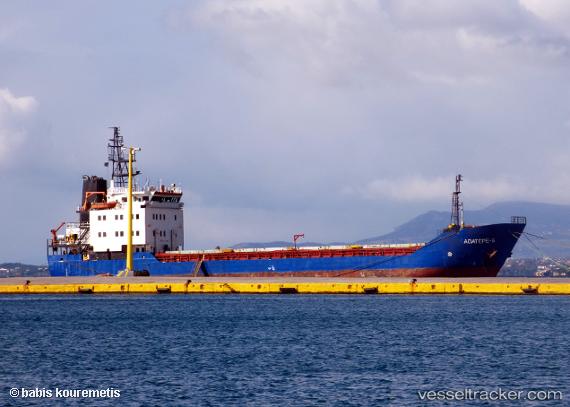
Vessel MKM ARIF BEY IMO: 8802466, MMSI: 577584000 General Cargo Ship
UTC, 39.80500, 18.65333, course: -1, speed: 5
UTC, 39.63667, 18.48167, course: -1, speed: 6
2026-01-30 08:01:18 UTC, 39.63667, 18.48167, course: -1, speed: 6
Live AIS position:
UTC. 12 nm SE of Leuca),
updated 2026-01-30 08:01:18 UTC.
Find the position of the vessel MKM ARIF BEY on the map. The latter are known coordinates and path.
marine traffic ship tracker show on live map
The current position of vessel MKM ARIF BEY is 39.63667 lat / 18.48167 lng. Updated: 2026-01-30 08:01:18 UTCCurrently sailing under the flag of Vanuatu
MKM ARIF BEY built in 1991 year
Deadweight:
2059 tDetails:
Last coordinates of the vessel:
UTC, 39.95408, 18.67514, course: 184, speed: 5.9UTC, 39.80500, 18.65333, course: -1, speed: 5
UTC, 39.63667, 18.48167, course: -1, speed: 6
2026-01-30 08:01:18 UTC, 39.63667, 18.48167, course: -1, speed: 6