 vesseltracker.com
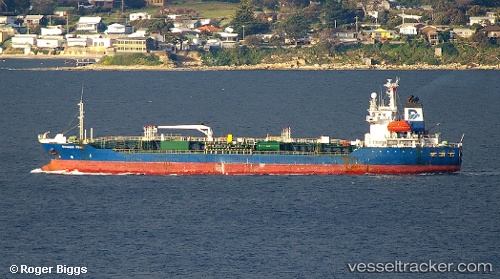
Vessel ANGEL 106 IMO: 9141895, MMSI: 577619000 Oil/Chemical Tanker
UTC, -6.34500, -167.86833, course: -1, speed: 1
UTC, -6.37339, -167.94054, course: 187, speed: 1.8
2026-02-27 23:54:55 UTC, -6.39674, -167.98572, course: 170, speed: 1.8
Live AIS position:
UTC. 227 nm SE of Sydney Island),
updated 2026-02-27 23:54:55 UTC.
Find the position of the vessel ANGEL 106 on the map. The latter are known coordinates and path.
marine traffic ship tracker show on live map
The current position of vessel ANGEL 106 is -6.39674 lat / -167.98572 lng. Updated: 2026-02-27 23:54:55 UTCCurrently sailing under the flag of Vanuatu
Details:
Last coordinates of the vessel:
UTC, -6.36300, -167.89619, course: 173, speed: 1.2UTC, -6.34500, -167.86833, course: -1, speed: 1
UTC, -6.37339, -167.94054, course: 187, speed: 1.8
2026-02-27 23:54:55 UTC, -6.39674, -167.98572, course: 170, speed: 1.8