 vesseltracker.com
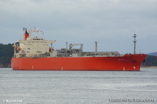
Vessel FOGAS IMO: 9012886, MMSI: 603911000 Lpg Tanker
UTC, 25.08715, 57.64419, course: 301, speed: 13.2
UTC, 25.41325, 57.23437, course: 325, speed: 13
2026-03-01 15:42:40 UTC, 25.60746, 57.08721, course: 326, speed: 10.3
Live AIS position:
UTC. 31 nm NE of Offshore Fujairah),
updated 2026-03-01 15:42:40 UTC.
Find the position of the vessel FOGAS on the map. The latter are known coordinates and path.
marine traffic ship tracker show on live map
The current position of vessel FOGAS is 25.60746 lat / 57.08721 lng. Updated: 2026-03-01 15:42:40 UTCCurrently sailing under the flag of Angola
Details:
Last coordinates of the vessel:
UTC, 24.88741, 58.07201, course: 299, speed: 13.4UTC, 25.08715, 57.64419, course: 301, speed: 13.2
UTC, 25.41325, 57.23437, course: 325, speed: 13
2026-03-01 15:42:40 UTC, 25.60746, 57.08721, course: 326, speed: 10.3