 vesseltracker.com
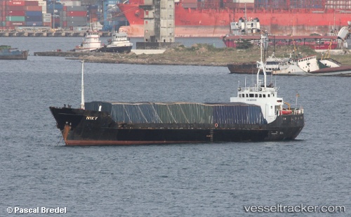
Vessel NIKY IMO: 6805165, MMSI: 613003582 General Cargo Ship
Live AIS position:
UTC. Near Marcos A. Gelabert International Apt/Panamá),
updated 2025-03-18 12:11:49 UTC.
Find the position of the vessel NIKY on the map. The latter are known coordinates and path.
marine traffic ship tracker show on live map
The current position of vessel NIKY is 8.97334 lat / -79.53805 lng. Updated: 2025-03-18 12:11:49 UTCCurrently sailing under the flag of Cameroon
NIKY built in 1967 year
Deadweight:
1160 tDetails:
Last coordinates of the vessel:
2025-03-18 12:11:49 UTC, 8.97334, -79.53805, course: -1, speed: 0