 vesseltracker.com
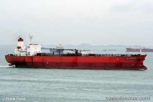
Vessel CELERIX IMO: 9222560, MMSI: 613139804 Oil Products Tanker
UTC, 12.33962, 43.88600, course: 112, speed: 7.3
UTC, 12.25316, 44.06748, course: 109, speed: 7.5
2026-03-19 10:11:21 UTC, 12.12288, 44.37090, course: 110, speed: 7.3
Live Vessel CELERIX Analytics (details, animations, etc.)
Live AIS position: UTC. 34 nm NW of Doraleh Container Terminal), updated 2026-03-19 10:11:21 UTC.Find the position of the vessel CELERIX on the map. The latter are known coordinates and path.
marine traffic ship tracker show on live map
The current position of vessel CELERIX is 12.12288 lat / 44.37090 lng. Updated: 2026-03-19 10:11:21 UTCCurrently sailing under the flag of Cameroon
Details:
Last coordinates of the vessel:
UTC, 12.48150, 43.56707, course: 112, speed: 7.4UTC, 12.33962, 43.88600, course: 112, speed: 7.3
UTC, 12.25316, 44.06748, course: 109, speed: 7.5
2026-03-19 10:11:21 UTC, 12.12288, 44.37090, course: 110, speed: 7.3