 vesseltracker.com
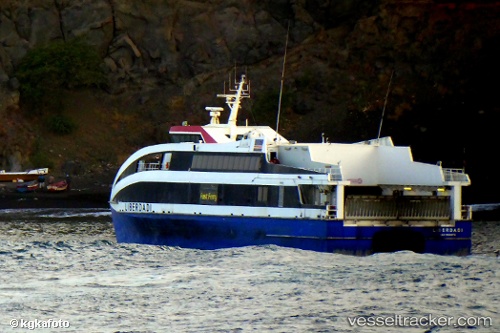
Vessel Liberdadi IMO: 9594092, MMSI: 617075000 Passenger Ro Ro Cargo Ship
UTC, 16.48069, -24.21048, course: 70, speed: 17.3
UTC, 16.54518, -23.86979, course: 64, speed: 16.6
2026-02-02 17:29:28 UTC, 16.68988, -23.36978, course: 62, speed: 16.3
Live AIS position:
UTC. 26 nm W of Ilha do Sal),
updated 2026-02-02 17:29:28 UTC.
Find the position of the vessel Liberdadi on the map. The latter are known coordinates and path.
marine traffic ship tracker show on live map
The current position of vessel Liberdadi is 16.68988 lat / -23.36978 lng. Updated: 2026-02-02 17:29:28 UTCDetails:
Last coordinates of the vessel:
UTC, 16.58751, -24.55005, course: 86, speed: 15.9UTC, 16.48069, -24.21048, course: 70, speed: 17.3
UTC, 16.54518, -23.86979, course: 64, speed: 16.6
2026-02-02 17:29:28 UTC, 16.68988, -23.36978, course: 62, speed: 16.3