 vesseltracker.com
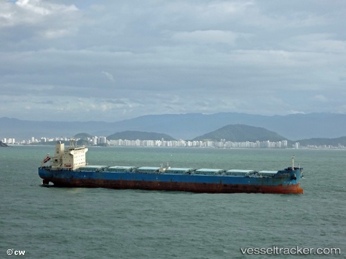
Vessel Wadi Alyarmouk IMO: 9460772, MMSI: 622120442 Bulk Carrier
UTC, 44.10819, 28.65490, course: 272, speed: 0.2
UTC, 44.10820, 28.65489, course: 272, speed: 0.1
2026-02-04 07:50:36 UTC, 44.10818, 28.65494, course: 273, speed: 0
Live AIS position:
UTC. Near Agigea),
updated 2026-02-04 07:50:36 UTC.
Find the position of the vessel Wadi Alyarmouk on the map. The latter are known coordinates and path.
marine traffic ship tracker show on live map
The current position of vessel Wadi Alyarmouk is 44.10818 lat / 28.65494 lng. Updated: 2026-02-04 07:50:36 UTCCurrently sailing under the flag of Egypt
Details:
Last coordinates of the vessel:
UTC, 44.10819, 28.65490, course: 273, speed: 0UTC, 44.10819, 28.65490, course: 272, speed: 0.2
UTC, 44.10820, 28.65489, course: 272, speed: 0.1
2026-02-04 07:50:36 UTC, 44.10818, 28.65494, course: 273, speed: 0