.
vessel VIEIRA IMO: 9234654, Crude Oil Tanker vesseltracker.com
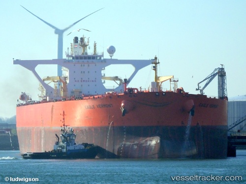
Vessel VIEIRA IMO: 9234654, MMSI: 626227000 Crude Oil Tanker

callsign: TRAM3
size: 60x333

Live AIS position: UTC. 33 nm NE of Longyan Pt), updated 2025-08-04 07:50:25 UTC.

Find the position of the vessel VIEIRA on the map. The latter are known coordinates and path.

marine traffic ship tracker show on live map

The current position of vessel VIEIRA is 37.69810 lat / 123.25156 lng. Updated: 2025-08-04 07:50:25 UTC

Currently sailing under the flag of Gabon

VIEIRA built in 2002 year

Deadweight:
306999 t

Details:


Last coordinates of the vessel:
2025-08-04 07:50:25 UTC, 37.69810, 123.25156, course: 108, speed: 11


Most frequent ports a vessels calls at VIEIRA (626227000):

Willemstad, traffic: 10
Sambu, traffic: 4
Singapore, traffic: 3
MELAKA, traffic: 2
Malacca, traffic: 2
TANAH MERAH, traffic: 1
Port Louis, traffic: 1
PENGERANG, traffic: 1
PULAU SAMBU, traffic: 1
BATU AMPAR, traffic: 1

Link to the map:


Find another ship

VIEIRA (626227000) last ports (portcalls and passsages)

PENGERANG | 2025-07-10 18:46:17
TANAH MERAH | 2025-07-10 17:30:06
PULAU SAMBU | 2025-07-10 16:46:11
MELAKA | 2025-07-09 04:42:38
MELAKA | 2025-07-05 04:21:03
Malacca | 2025-07-05 04:09:24
Willemstad | 2025-05-09 11:19:55
Willemstad | 2025-05-02 19:31:31
Willemstad | 2025-04-21 15:18:15
Willemstad | 2025-04-16 14:16:33
Willemstad | 2025-04-04 14:48:48
Singapore | 2024-09-28 23:56:00
Singapore | 2024-09-22 00:56:41
Singapore | 2024-09-10 18:28:31
Port Louis | 2024-08-18 04:34:48
Willemstad | 2024-07-11 20:34:35
Willemstad | 2024-07-07 10:25:30
Willemstad | 2024-07-02 16:30:36
Willemstad | 2024-06-26 11:38:52
Willemstad | 2024-06-18 19:05:37