 vesseltracker.com
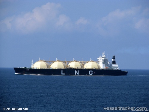
Vessel Al Hamra IMO: 9074640, MMSI: 636010544 Lng Tanker
UTC, 25.15726, 52.88710, course: 345, speed: 0
UTC, 25.15726, 52.88710, course: 345, speed: 0
2026-02-07 13:28:13 UTC, 25.15727, 52.88711, course: 345, speed: 0
Live AIS position:
UTC. Near Das Island),
updated 2026-02-07 13:28:13 UTC.
Find the position of the vessel Al Hamra on the map. The latter are known coordinates and path.
marine traffic ship tracker show on live map
The current position of vessel Al Hamra is 25.15727 lat / 52.88711 lng. Updated: 2026-02-07 13:28:13 UTCCurrently sailing under the flag of Liberia
Al Hamra built in 1997 year
Deadweight:
72990 tDetails:
Last coordinates of the vessel:
UTC, 25.15724, 52.88708, course: 346, speed: 0UTC, 25.15726, 52.88710, course: 345, speed: 0
UTC, 25.15726, 52.88710, course: 345, speed: 0
2026-02-07 13:28:13 UTC, 25.15727, 52.88711, course: 345, speed: 0