 vesseltracker.com
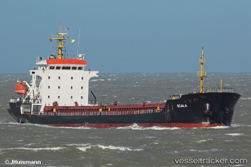
Vessel Scala IMO: 9370628, MMSI: 636012769 General Cargo Ship
UTC, 41.45778, 29.06179, course: 228, speed: 4.9
UTC, 41.44909, 29.04263, course: 220, speed: 0.1
2026-01-30 01:52:52 UTC, 41.44803, 29.03458, course: 178, speed: 0.4
Live AIS position:
UTC. 13 nm N of RUMELI FENERI),
updated 2026-01-30 01:52:52 UTC.
Find the position of the vessel Scala on the map. The latter are known coordinates and path.
marine traffic ship tracker show on live map
The current position of vessel Scala is 41.44803 lat / 29.03458 lng. Updated: 2026-01-30 01:52:52 UTCCurrently sailing under the flag of Liberia
Scala built in 2005 year
Deadweight:
6826 tDetails:
Last coordinates of the vessel:
UTC, 41.70861, 29.22846, course: 187, speed: 8.6UTC, 41.45778, 29.06179, course: 228, speed: 4.9
UTC, 41.44909, 29.04263, course: 220, speed: 0.1
2026-01-30 01:52:52 UTC, 41.44803, 29.03458, course: 178, speed: 0.4