 vesseltracker.com
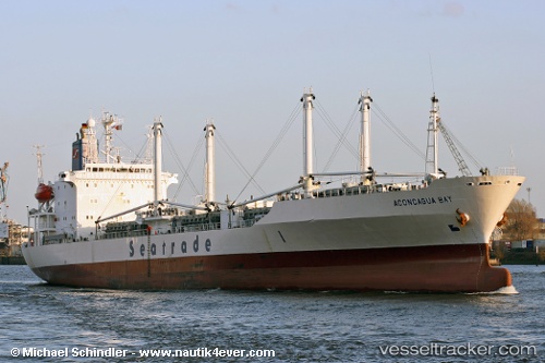
Vessel Aconcagua Bay IMO: 9019652, MMSI: 636013146 Refrigerated Cargo Ship
UTC, 35.38398, -71.19241, course: 345, speed: 14.9
UTC, 35.96098, -71.35784, course: 353, speed: 12.6
2026-03-13 01:41:36 UTC, 36.27658, -71.43786, course: 348, speed: 8.9
Live Vessel Aconcagua Bay Analytics (details, animations, etc.)
Live AIS position: UTC. 161 nm N of Ben Slimane), updated 2026-03-13 01:41:36 UTC.Find the position of the vessel Aconcagua Bay on the map. The latter are known coordinates and path.
marine traffic ship tracker show on live map
The current position of vessel Aconcagua Bay is 36.27658 lat / -71.43786 lng. Updated: 2026-03-13 01:41:36 UTCCurrently sailing under the flag of Liberia
Aconcagua Bay built in 1992 year
Deadweight:
11581 tDetails:
Last coordinates of the vessel:
UTC, 35.05191, -71.12317, course: 357, speed: 15.2UTC, 35.38398, -71.19241, course: 345, speed: 14.9
UTC, 35.96098, -71.35784, course: 353, speed: 12.6
2026-03-13 01:41:36 UTC, 36.27658, -71.43786, course: 348, speed: 8.9