 vesseltracker.com
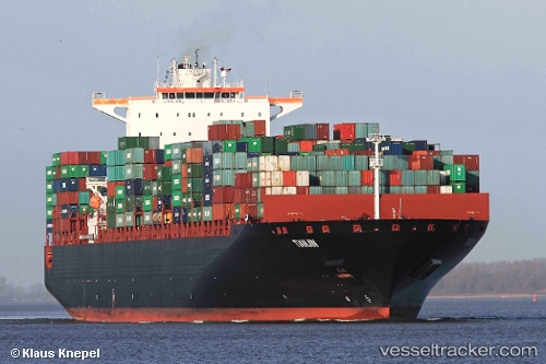
Vessel Tianjin IMO: 9398462, MMSI: 636014224 Container Ship
UTC, 24.35787, 119.10548, course: -1, speed: 10.6
UTC, 24.62918, 119.45415, course: 45, speed: 11.7
2026-03-04 23:44:21 UTC, 24.85655, 119.74065, course: 50, speed: 10.5
Live Vessel Tianjin Analytics (details, animations, etc.)
Live AIS position: UTC. 21 nm S of Damaiyu), updated 2026-03-04 23:44:21 UTC.Find the position of the vessel Tianjin on the map. The latter are known coordinates and path.
marine traffic ship tracker show on live map
The current position of vessel Tianjin is 24.85655 lat / 119.74065 lng. Updated: 2026-03-04 23:44:21 UTCCurrently sailing under the flag of Liberia
Details:
Last coordinates of the vessel:
UTC, 24.13735, 118.83287, course: 41, speed: 9.7UTC, 24.35787, 119.10548, course: -1, speed: 10.6
UTC, 24.62918, 119.45415, course: 45, speed: 11.7
2026-03-04 23:44:21 UTC, 24.85655, 119.74065, course: 50, speed: 10.5