 vesseltracker.com
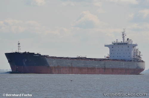
Vessel Hermes IMO: 9613056, MMSI: 636015035 Bulk Carrier
UTC, -15.01500, 66.29333, course: -1, speed: 10
UTC, -14.90500, 66.44167, course: -1, speed: 9
2026-02-20 22:19:26 UTC, -14.63833, 66.82500, course: -1, speed: 10
Live AIS position:
UTC. 360 nm NE of Port Mathurin),
updated 2026-02-20 22:19:26 UTC.
Find the position of the vessel Hermes on the map. The latter are known coordinates and path.
marine traffic ship tracker show on live map
The current position of vessel Hermes is -14.63833 lat / 66.82500 lng. Updated: 2026-02-20 22:19:26 UTCCurrently sailing under the flag of Liberia
Hermes built in 2012 year
Deadweight:
75200 tDetails:
Last coordinates of the vessel:
UTC, -15.26833, 65.94833, course: -1, speed: 9UTC, -15.01500, 66.29333, course: -1, speed: 10
UTC, -14.90500, 66.44167, course: -1, speed: 9
2026-02-20 22:19:26 UTC, -14.63833, 66.82500, course: -1, speed: 10